Shrewsbury
The Lion Hotel sits on a steeply sloping street called Wyle Cop, which is the main road into the old city of Shrewsbury. It occupies three conjoined buildings. Two of them are 18th Century Georgian; an older 15th/16th Century building is squeezed between them – except that it was there first, obviously. From the late 18th Century and well into the 19th, The Lion was the centre of sophisticated social life in the town. An Adams style ballroom (upstairs) and an assembly room (immediately below) were added. They are both still there looking splendid, with multiple stone fireplaces, period chandeliers and wall panel motifs straight off a Wedgewood vase. The ballroom was in social use on both nights of my stay, although judging from what I heard (voices and ‘music’), sophistication may have been lacking.
The Lion was a major Coaching Inn and boasts a list of famous persons who stayed there, both in coaching days and after the railway arrived and rendered the coach service obsolete. These included : Paganini (violinist), Jenny Lind (singer), Charles Dickens (probably on one of his reading tours), Thomas De Quincey (essayist and opium addict, lodged in the ballroom for lack of available guest rooms), Nathaniel Hawthorne (American novelist – ‘Easy reading is damn hard writing’. True.) and Benjamin Disraeli (the town’s M.P. from 1841 to 1843, and Prime Minister twice).
However, what the Hotel currently highlights – by means of a framed account on the Bar wall – is that Charles Darwin woz here. Darwin was born and brought up in Shrewsbury, so perhaps the Lion was his local. What the framed account focuses on, though, is the fact that he left the Lion in a great hurry in order not to be gazumped for the post of Ship’s Naturalist on HMS Beagle. He shot off to London, by coach.
The Lion was also famous, in the 1820s, for the manner of arrival of the London Coach. People would gather to watch whenever driver Samuel Hayward was in charge of the horses. He would cross the English Bridge (over the Severn), drive up Wyle Cop at full gallop and then, without a pause, take a left into the Lion’s yard – through an entrance hardly wider or higher than his coach. He did this for fifteen years without mishap, and never more than fifteen minutes late against the timetable. Mind you, there’s clear evidence of wear on the entrance post – but probably this was caused by other, less talented drivers.
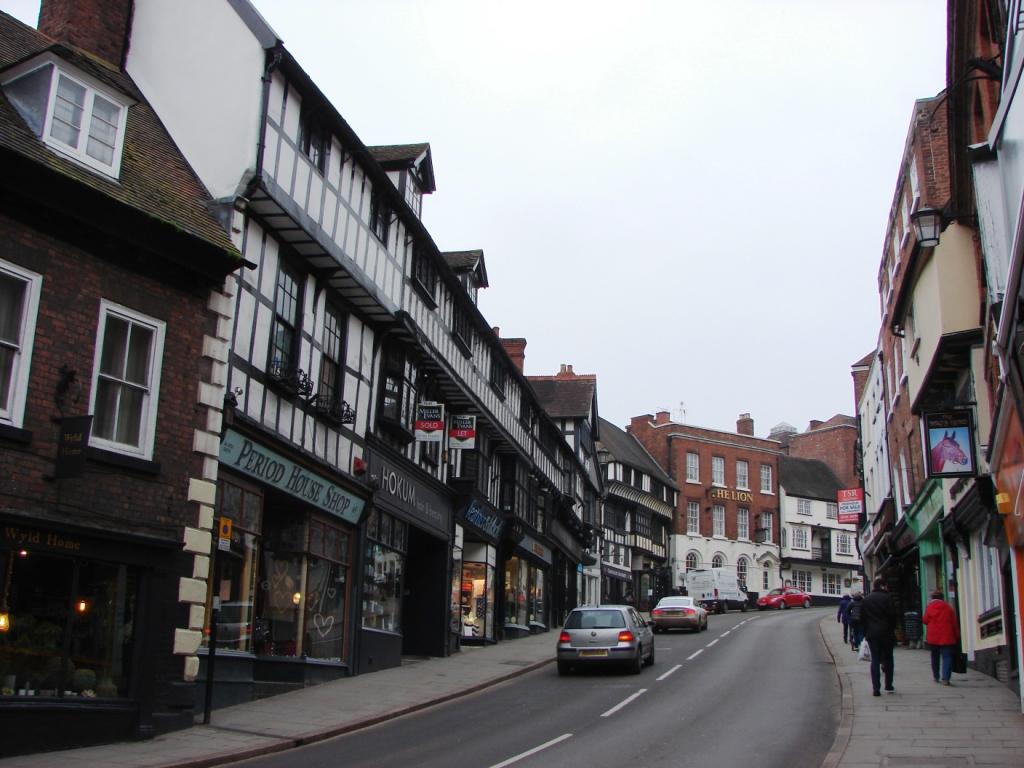
Wyle Cop, Shrewsbury.
The Lion ( which starts at the Georgian building at the top of the hill) is preceded on Wyle Cop by an uninterrupted row of imposing Tudor, timber-framed buildings. They loom four stories high – including the rooms in the roof revealed by windowed gables. According to one report, this part of Shrewsbury suffered a great fire in the 1390s, and so these buildings date from the 1400s. What struck me was how many Tudor buildings there are in the town, and how well preserved they are. This was not only the case in old Shrewsbury but, as I discovered, in other local market towns too – Ludlow, Much Wenlock and Church Stretton. This abundance contrasts with what I am familiar with in Hampshire. Tudor houses down South are far fewer and not so many half so grand. My first theory was to recall that the South was, before the middle of the 19th Century, a relatively backward area economically. Lacking in coal, the Industrial revolution carried on without it. In Shropshire they would have been producing wool by the bargefull, followed by coal and iron. This means they would have been able to afford the maintenance of these fine houses over the centuries, while down South many would have decayed and been dismantled. My second theory was the opposite. Perhaps there was more money down South so that owners could afford to raze their by then old fashioned dwellings and replace them with something new – something Georgian perhaps. In Shropshire, for lack of funds, they just had to keep their houses going. I lean to the first explanation, but I cannot find anything to confirm or deny my speculations in either direction.
*
Wenlock Edge
I came to Shrewsbury for four reasons : to meet an old friend; to visit Ironbridge, to climb The Wrekin and to explore Wenlock Edge. The first three went well. Wenlock Edge was problematic.
Any mention of Wenlock Edge (or The Wrekin) requires the following quote from A. E. Houseman :
On Wenlock Edge the wood’s in trouble;
His forest fleece the Wrekin heaves;
The gale, it plies the saplings double,
And thick on Severn snow the leaves.
This is the first verse of poem 31 from Houseman’s first and most famous collection, A Shropshire Lad (1887). Which he was not. He was born and brought up near Bromsgrove in Worcestershire, near the industrial city of Birmingham. However, that’s only some thirty miles from Wenlock Edge and the Shropshire Hills, which lie to the romantic west (well, north west), towards mysterious Wales, in the opposite direction from Birmingham. He seems to have viewed the hills as a kind of inaccessible Eden, so that he could also write poem number 40:
Into my heart an air that kills
From yon far country blows:
What are those blue remembered hills,
What spires, what farms are those?
That is the land of lost content,
I see it shining plain,
The happy highways where I went
And cannot come again.
Houseman wrote most of these poems while living in Highgate in London, and before he ever actually visited Shropshire. In fact he said himself that his Shropshire was `not exactly a real place.’
I mention Houseman not only because of the obligatory quote, but also because he is one of my favourite poets. I prefer my poems short. Wordsworth’s Lucy Poems, for example (rather than The Prelude . . . ); Emily Dickinson (the complete works – everything).
Here’s one of Houseman’s best ( Shropshire Lad, poem 2):
Loveliest of trees, the cherry now
Is hung with bloom along the bough,
And stands about the woodland ride
Wearing white for Eastertide.
Now, of my threescore years and ten,
Twenty will not come again,
And take from seventy springs a score,
It only leaves me fifty more.
And since to look at things in bloom
Fifty springs are little room,
About the woodlands I will go
To see the cherry hung with snow.
This is Houseman about as optimistic as he gets.
It was undoubtedly my familiarity with the mentions of Wenlock Edge and The Wrekin in Housman’s poem above that prompted my desire to visit both. I drove up via Ludlow, which lies just south of the boundary of the Shropshire Hills Area of Outstanding Natural Beauty. I took the road that runs directly north from there, through the racecourse, and came to Wenlock Edge just short of its south-western end at the village of Pedlar’s Rest. I turned right. Wenlock Edge rose rather gently to its long ridge to my left and a small river ran through the fields to my right. All very pleasant, but not very remarkable. A gentle slope, not a great rise. I continued on, passing through the delightfully named village of Diddlebury, until I came to the more practically named village of Beambridge. I noticed from my road map that there was from there a lane across and over the Edge. Perhaps this would bring me to the top and provide a somewhat more dramatic prospect?
It proved to be – sensibly with hindsight – more of a pass through the Edge than a route to its top. Hills rose on either side – fields and woods beyond – so that there was no view to be had until a final rapid descent of the Edge on its northern slope. There was then a brief glimpse over the flat lands ahead, to the next ridge of hills in the distance, but by this time the road was already well down from its highest point and wooded on either side, restricted what could be seen. I came to the road that runs along the northern edge of the Edge and turned right towards Much Wenlock. This was much better. The ridge rose steeply to my right and after a few miles things got better still as the road climbed the slope obliquely until it was running along the crest. The view, however, was to the right, down to the river valley again, as the view left was obscured by trees. Finally the road descended – on the right-hand slope – to Much Wenlock.
Before I climbed to the crest I had taken a brief detour in response to a sign for Wilderhope Manor – National Trust. It proved to be an austere Elizabethan house which had the air of a castle. Not that it was crenulated or surrounded by a moat, but it looked as though it would be fairly defendable against an unwanted intruder. It serves now as a seasonal youth hostel.
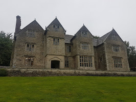
Photo : Adrian Paliczka 2016 (on Google)
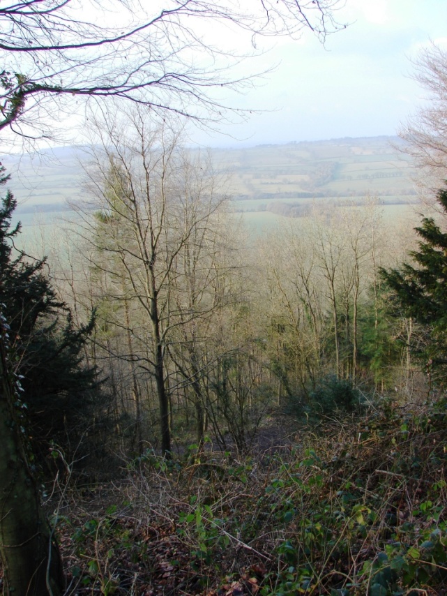
Still, I had not had my fill of Wenlock Edge. Just passing over and along was not at all satisfactory. I needed to give it another go. So a few days later I returned to where I’d seen a National Trust sign – at Presthope. I parked up, and went for a walk. A footpath ran through mostly deciduous woods on the narrow crest of the ridge. It being February, the trees were leafless, but they still prevented a satisfactory view of the landscape below. However, once or twice a gap in the woods allowed better. Some clearing of the trees had been done, allowing a view across the valley of the Harley Brook to Grange Hill and the next ridge north.
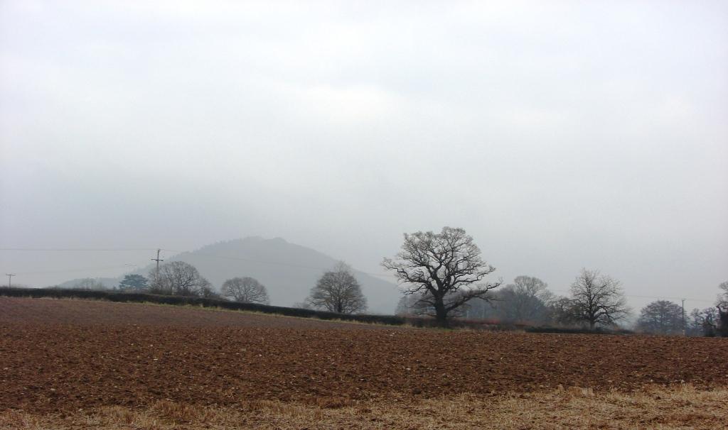
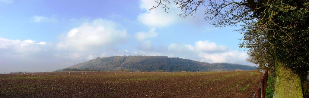
The Edge is made of limestone. It was originally a reef in a tropical sea – but that was some time ago. It is now rises a thousand feet above sea level and runs for about 17 miles straight and narrow from just north of Craven Arms in the south-west to Much Wenlock in the north-east. It rises in the landscape like a frozen wave not quite ready to break.
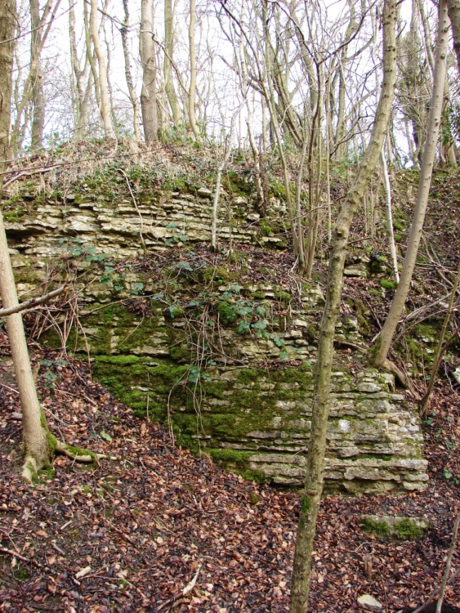
The limestone has long been quarried and it used to be burnt on the Edge for use in making quicklime and mortar. I thought I had come upon one of the old kiln sites – where they did the burning – when I spotted a wall of limestone blocks. But closer inspection showed it was probably just the edge of where limestone had once been quarried, revealing the layered beds laid down millions of years ago. The layers are horizontal, just as they first grew as the reef was constructed by the gradual accumulation of quintillions of microscopic sea shells.
The footpath suddenly left the wood and I found myself looking down and across a modern, working quarry, a great scar along the side of the hill, only relieved by a bright blue lake formed in the deepest part of the excavation. This is Lea Quarry and it runs for about two miles, very nearly as far as Much Wenlock. This was not at all to my taste so I retraced my steps through the wood, back to the car, and left.
I didn’t have the time to explore further in search of a more satisfying experience, so Wenlock Edge remains something of a disappointment. Unlike my visit to The Wrekin.
*
The Wrekin
The weather was very changeable the day I visited the Wrekin[1] – mostly overcast with the occasional drizzle. Very February. The hill is visible from miles around.
It looks like a volcano, but it isn’t. Nor is it a limestone reef. On the whole -` the geology is complex’ – it is made up of thick layers of solidified lava erupted from volcanoes long gone, so it quite safe to climb nowadays – weather permitting. The Wrekin sits, to the east-south-east of Shrewsbury and somewhat west of Telford.
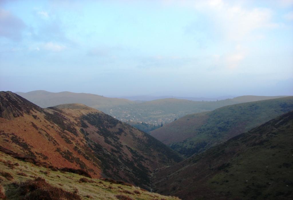
The sun came out :
This is a view from the south-east, not far from Little Wenlock. The hill is just under two miles (3 kms) long by a little more than half a mile (0.6 kms) wide. Its highest point is 1,335 feet (407 metres) above sea level and maybe about 650 feet (200 metres) above the field in the photograph. It rises steeply on both sides, as well as at its ends. It cannot be missed.
I parked at Forest Glen, between the Wrekin and the smaller hill to the north east known as The Ercall – a continuation of the ancient lava beds. A very reasonable track led up from there through the oak woods – with a dash of beech, birch and ash. Half way up it started to snow. Not flakes, but a fine dust which soon began to settle on the woodland floor. I met some folks coming down. I asked them to let the authorities know if I didn’t make it back.
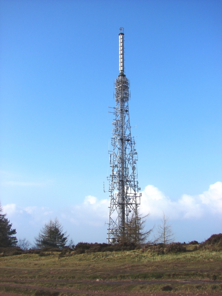
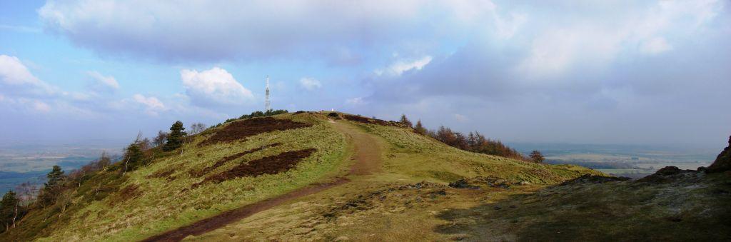
By the time I reached the edge of the oak woods, where it gave way to scrub and pines, it had stopped snowing and the sun was out again. At this point I entered Hell’s Gate . . . That is, I passed between the outer embankments of an iron age hill fort which sits on and around the summit of the Wrekin. A small while further on I passed through Heaven’s Gate. I was saved. Compared with the southern chalk-hill forts with which I am more familiar, the embankments here – an outer ring and an inner ring – were far less conspicuous or complete. In fact I wondered how they’d managed to build anything in this rocky terrain with little or no soil, enclosing some 20 acres (8ha) of the summit. More conspicuous was a 171 feet tall (52 metres) radio and telecommunications mast festooned with aerials and dishes and topped with a spiralling column whose function was a mystery.
I wondered what the original inhabitants of the hill fort might have made of it.
The construction of the tower, in 1975, on the top of The Wrekin was of course controversial. I would have opposed it too, but in fact I rather thought it added a touch of entertainment to the summit. The spiral column, by the way, is for the broadcasting of digital television. There is a light on at the top at night time. The mast is therefore known locally as the Wrekin Beacon.
I sat and ate my lunch – in the sunshine – beyond the top on a protrusion of rock with unencumbered views in most directions. The River Severn meandered below, on its way between Shrewsbury and the southern edge of Telford.
Being such a prominent feature on the landscape, it is no surprise to find that The Wrekin has a story to go with it concerning its origin. For reasons unknown, a Welsh giant by the name of Gwendol was not at all happy with the townsfolk of Shrewsbury. He took a giant-size spade-full of earth and set off with the intention of dumping the earth in the Severn and thereby flooding the town. On his way there, in the vicinity of Wellington (which is to the east of Shrewsbury; Wales is to the west; presumably he’d got lost) he met a cobbler carrying a sack-full of old shoes. Gwendol asked the cobbler the way to Shrewsbury and also told him why he was going there. The cobbler was a quicker thinker than the giant and immediately emptied his sack of old shoes on to the ground and told the giant it was a long, long way to Shrewsbury – look how many pairs of shoes he’d worn-out walking here from there ! This was the last straw for the by now weary giant and he abruptly dumped his spade-full of earth there where he stood. He scraped the mud off his boots and stomped off home to Wales. The spade-full of earth became The Wrekin and the mud off his boots became the adjacent Ercall. The same tale is told for the origins of Silbury Hill – a neolithic construction, not a natural feature – in Wiltshire. Only there it’s the devil, not a giant, and he’s out to get nearby Marlborough. A tailor plays the same trick though.
*
The Long Mynd
My Shrewsbury friend had advised me to visit Church Stretton. I found a small market town with the customary smattering of Elizabethan buildings – and a large supermarket. I wandered up and down the main street looking for a cup of coffee and surveying the buildings. I wondered quite why my friend had sent me there. It was pleasant enough – the old part of the town – but there wasn’t a great deal of it, and the modern intruded very close by. In any case, it was late afternoon by then and time I was heading back to Shrewsbury.
According to my road map, there was a thin lane heading up over the hills above the town and in the direction, roughly, of Shrewsbury. I found it easily and began to climb. I had hardly left the edge of the village when I came to a cattle grid and suddenly there were sheep-grazed, heather-moorland slopes rising on either side. This was something startling after the wooded slopes and fields of the other hills around. I’d thought Shropshire was part of England’s green and pleasant land, not sporting wild uplands where red grouse and ravens might dwell (which they do in fact). I drove through an open ‘Snow Gate’ – recently installed to be used against the many motorists who have otherwise to be rescued from the moor each winter. I also passed through the Devil’s Mouth I discover, but I was not aware of it at the time. Although the road rose steeply at first, it soon levelled off and the hills became an undulating plateau stretching away in all directions, with deep cut valleys. I had discovered The Long Mynd.
Mynd means mountain in Britonic, the Celtic language of the ancient Britons. The hills are 7 miles (11 km) long, up to 3 miles (5 km) wide and 1,693 feet (516 m) high at a gentle peak on the plateau called Pole Bank. The hills are made mostly of sandstone, having once been an ocean bed, though not a reef.
I stopped again not far from Pole Bank at a spot called Shooters Box. It seems there used to be a small building there constructed as a hide for the purpose of slaughtering grouse. It had been conveniently dug into the side of a Bronze Age disc barrow, the only one of its kind in Shropshire. It has now been removed.
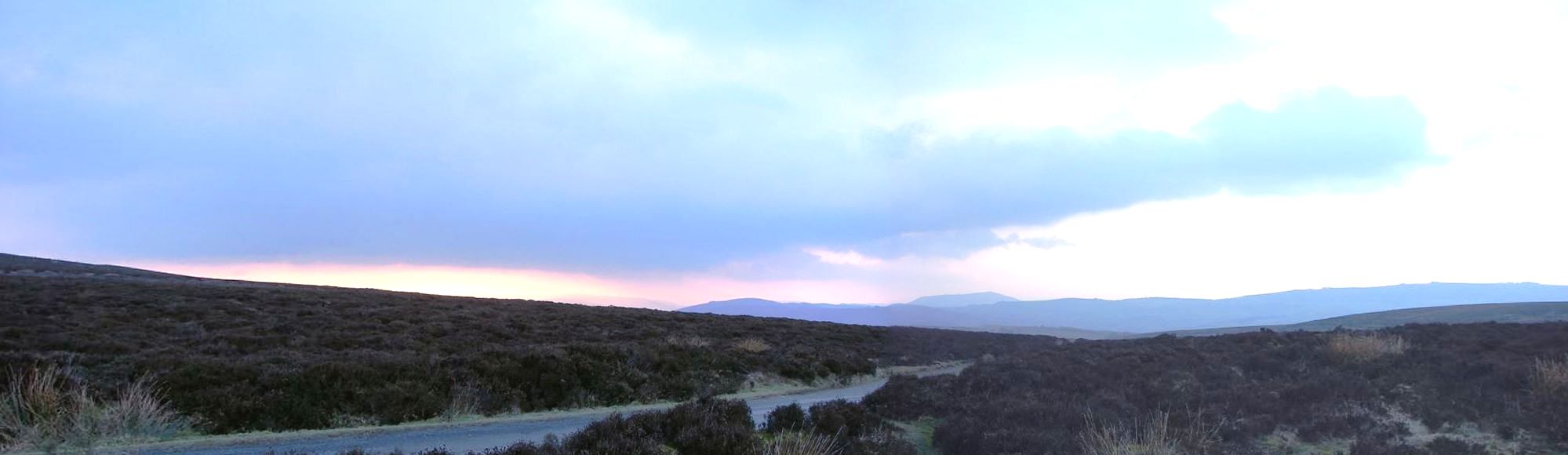
This is the view west from Shooting Box – the flat-topped peak in the distance may be Heath Mynd, belonging to the next ridge of Shropshire hills, possibly the Stiperstones – whose most famous feature is a rugged rock outcrop called the Devil’s Chair. (They do seem keen on the devil round these parts).
A couple of elderly gents in walking-gear appeared. The daylight was not far from done and we were in the middle of nowhere. I offered them a lift. Not necessary. They’d just strolled up from one of the nearby villages for a walk, as was their habit. We chatted. They thanked me. I left them to the dusk.
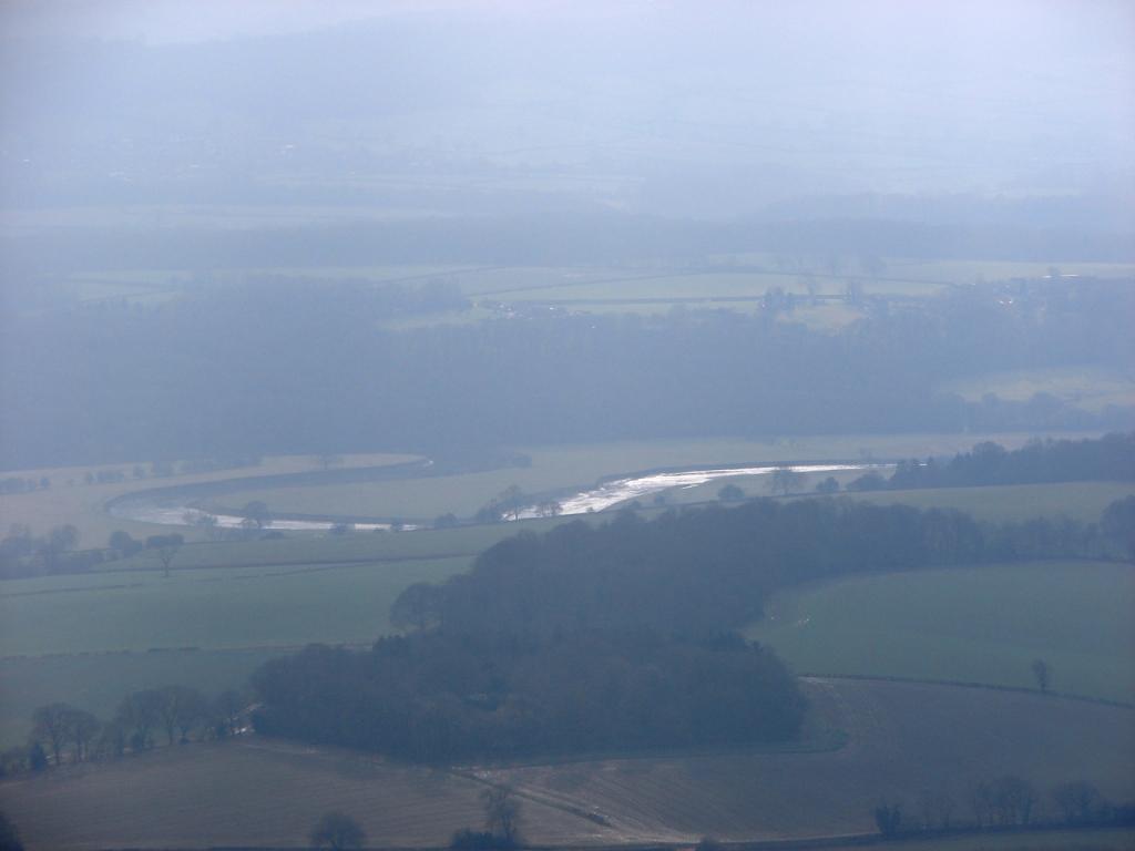
Not far after Shooting Box the road descended steeply to Ratlinghope and on to the village of Bridges. A rural road took me back to Shrewsbury, with a river on my left – the East Onny – and steep slopes immediately to my right – Stitt Hill and Cothercott Hill – the outer, western ramparts, I would say, of the great Wynd.
I only wished I’d discovered this treasure earlier in the day and earlier in my stay.
*
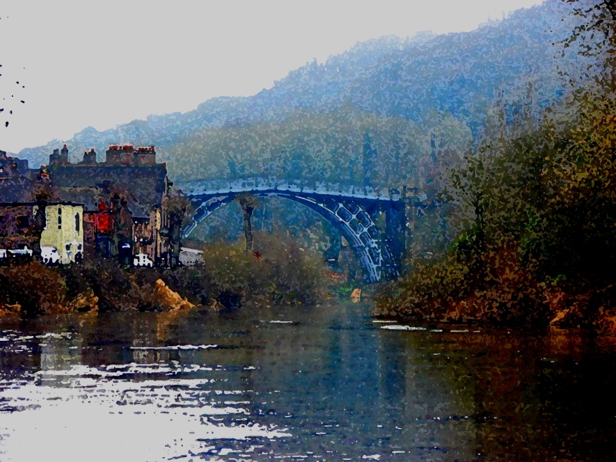
Ironbridge
I had begun the day with a visit to Ironbridge.
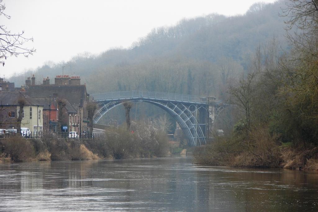
I first heard about the iron bridge – at Ironbridge, over the River Severn – while studying the history of art. It was the first ever bridge built of cast iron – completed in 1780 – and it is indeed a work of art. Other cast iron structures, such as the Ditherington Flax Mill (1796 – the first cast iron building), the Brighton Pavilion, the Eifel Tower and the Crystal Palace followed later – plus lots of railway bridges, including the Tay Bridge unfortunately – famous for collapsing in 1879 as a passenger train passed over, tipping train, passengers and crew into the dark waters below.
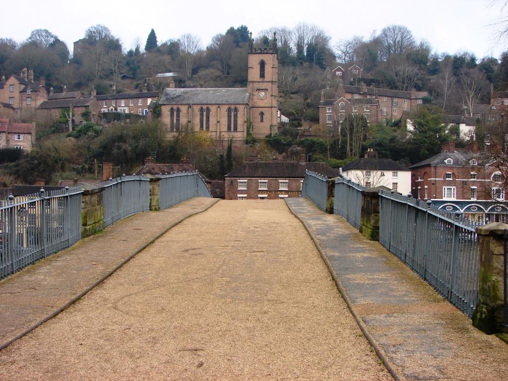
Fortunately the Ironbridge remains intact in spite of its years. A great many repairs have been made to the masonry towers, but apart from a section of deck plate which fell from the bridge in 1903, the bridge has been amazingly durable. The road deck has been lightened and traffic has been banned from crossing since 1934, but it remains open for pedestrians to stroll across – which indeed I did.
First, though, I walked underneath to inspect the iron structure in more detail. That which had looked so elegant and simple, if a little decorative, at a distance, became very complicated up close. I particularly enjoyed the curious ties between the curved spans.
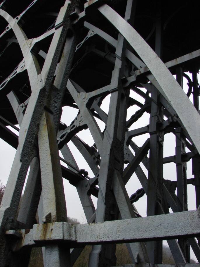
When I then walked across the bridge I was struck by the fact that while the iron arches of the structure are uniformly curved, the deck or roadway is made up of two flat surfaces meeting, more or less, at a point. The architect – a Mr Thomas Pritchard – presumably felt a level deck all the way would be a step too far for this novel structure. I also noticed that there was a certain amount of undulation in the ‘flat’ road surface, but I hadn’t heard then about the plummeting deck plate of 1903 so I was not concerned.
After the bridge I visited the Museum of the Gorge in order to become better informed. While the bridge and the settlement which grew up around it are known as Ironbridge, this stretch of the River Severn is known as the Gorge, it being narrow, with hills rising steeply on either side.
The museum is located a little way downstream from the bridge. It is housed in a neo-gothic, crenulated and twin-towered building which suggests a serious dalliance between a Victorian church and a medieval castle. It was built in 1840 – as a warehouse. Narrow tracks – grooves in the paving stone – run down steeply to a stone quay along the river’s edge. Boats and barges were loaded here with the various manufactures of the immediate area, including those from the iron works at Coalbrookdale, hardly a mile away up a non-navigable tributary stream.
Coalbrookdale and the Gorge are commonly referred to as the birthplace of the Industrial Revolution. Iron, ceramics and other goods were already being manufactured here based on the easily accessible ironstone, low-sulphur coal, sandstone and clay variously exposed in the sides of the Gorge, and the use of the river for transport. Things really got going, however, when Abraham Darby, a maker of brass and iron pots, leased a furnace at Coalbrookdale in 1709 and started smelting iron using coke rather than coal or charcoal. He had already been smelting copper with coke elsewhere and seems to have been immediately successful in applying the technique to iron. The greater heat produced by coke soon enabled him to build bigger kilns and improve the efficiency of the process significantly. Darby seems to have been quite willing to share his new technology – in any case, he probably couldn’t keep it secret – and coke soon became the fuel of choice for iron smelting, leading to a rapid increase in production and use of cast iron across the country and beyond.
Coalbrookdale and the Gorge had already seen plenty of fire and smoke, coal dust and ash. They now increased mightily. This was noticed by visitors at the time who commented on the pollution and likened the Gorge to the Underworld and the river to the Styx. Destruction was being wrought upon the green and pleasant land :
Sonnet LXIII. To Colebrooke Dale – Anna Seward (1790 ?)
Thy GENIUS, Colebrooke, faithless to his charge,
Amid thy woods and vales, thy rocks and streams,
Form’d for the Train that haunt poetic dreams,
Naiads, and Nymphs, – now hears the toiling Barge
And the swart Cyclops ever-clanging forge
Din in thy dells; – permits the dark-red gleams,
From umber’d fires on all thy hills, the beams,
Solar and pure, to shroud with columns large
Of black sulphureous smoke, that spread their veils
Like funeral crape upon the sylvan robe
Of thy romantic rocks, pollute thy gales,
And stain thy glassy floods; – while o’er the globe
To spread thy stores metallic, this rude yell
Drowns the wild woodland song, and breaks the Poet’s spell.
Now this would not be included among my favourite poems – though short – but it does show that not everyone was happy with the Industrial Revolution right from the start. I’m not sure about this painting though. It seems to me both hellish and a celebration – which is probably a reasonable assessment of the whole venture.
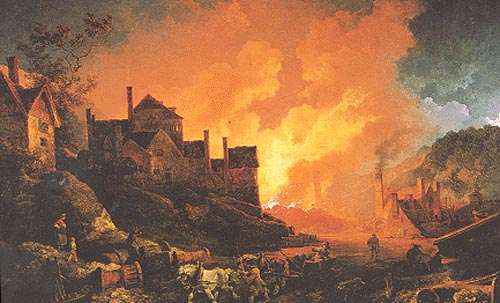
Coalbrookdale by Night (1801) by Philip James de Loutherbourg.
It was Darby’s grandson – Abraham Darby III – who built the Ironbridge. He had inherited the Coalbrookdale works at the age of thirteen and taken over the management when he was eighteen. Being a Quaker, he not only attended to the business as such but also to the wages and living conditions of his workers. He even bought up local farms to provide food for them. Despite his good deeds, though, he died at the age of 39. His grandfather had died at only 38. The Abraham Darby in between had made it to 51. However, short lives notwithstanding, between them they had, for better or for worse, played a major part in launching the Industrial Revolution.
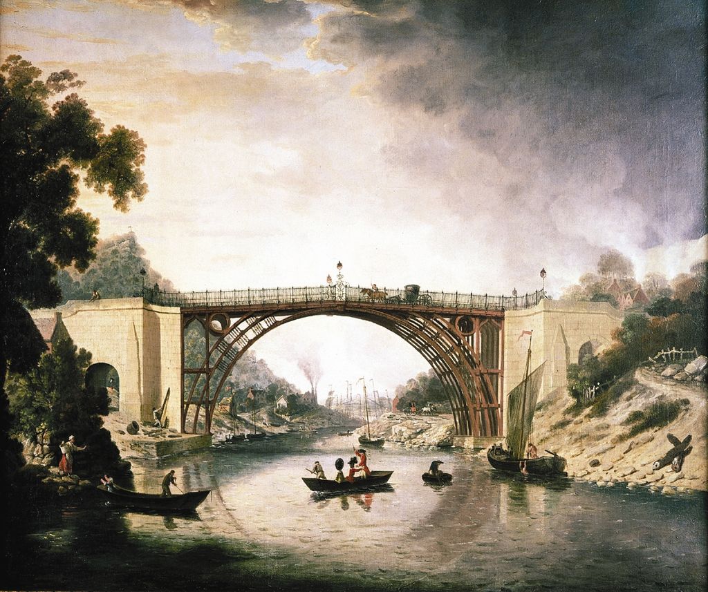
The cast iron bridge near Coalbrookdale – William Williams (c. 1780)
The most striking exhibit in the Museum is a 40 feet (12 metre) long model depicting the Gorge as it was in the year 1796, at the time of a visit by King George III and Queen Charlotte. They had come to see both the bridge and the manufacture of cannons. Cannons were important because the country was at the time at war with France following the French revolution. (I read somewhere – perhaps in the Museum – that the Darby’s, being Quakers, never made cannons, but others did). I do like a good model, a miniature rendition of the world which one can look down upon as if from an aeroplane, or like a soaring eagle, or like a God . . .
Anyway, it reminded me that I really must get my model railway set up soon.
The other most striking thing was not an exhibit as such but a record of flood levels drawn on the wall of the apse-like room which looked out through tall lancet windows over the river, originally an office. It is a long way above the river. It is quite impossible that the river could even rise to its floor level. Meanwhile, there were holes at floor level made to let water that flowed in flow out again . . .
There was a line drawn round the wall to show where the river had reached in the year 1795. The line was just below the tops of the lancet windows. The windows are about seven feet tall. Subsequent floods of not much lower heights were also indicated – some of them not so long ago. When I left the Museum I complimented the ladies at the desk for their fine museum but also indicated that I had seen the flood level markers and that it was clearly far too dangerous a place to stay a moment longer. I was off up the hill to Coalbrookdale. They were kind enough to be amused.
It turns out that the Gorge floods every year. Rainwater enters the Severn from a wide area upstream, including from the famously wet hills and mountains of central Wales. First the waters flood Shrewsbury and then they squeeze into the narrow Gorge and rage through Ironbridge. The most recent flood, rivalling that of 1795, was on the 1st of November 2000 – either 19’6” (6 m) or 23’ (7 m), depending on your sources. Since then, temporary flood barriers have been deployed to good effect.
The great thing is, though, that the Iron Bridge has survived them all.
*
-
Pronounced reekin. ↑